Long-range Outlook: 24/10/05 - 29/10/05
Rain, rain & more rain. Gales too!
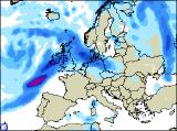
Click here for details of the weather over the next few days.
Please note that forecasting beyond five days is notoriously difficult, and small errors at short-range can lead to large deviations further in time. Our longer-range forecasts are based on the most accurate weather data available at the time, but alterations may be required as the period progresses. Please check back regularly for the most up-to-date forecast run.
Monday 24/10/05 to Tuesday 25/10/05
Monday's weather is expected to set the trend for much of the coming week - wet and windy! With a huge area of low pressure anchored in the Atlantic, weather fronts will give heavy and persistent rain to much of the UK and Ireland on Monday. The rain will be particularly heavy across Scotland, northern England, Wales and the Republic of Ireland. The best chance of seeing any brightness will be in south-east England, where it could just remain dry. A fresh to strong south-westerly wind everywhere, but it will remain mild. A smaller yet intense area of low pressure looks set to swing across the UK on Tuesday, bringing gale force winds to Irish Sea coasts of England and Wales, and perhaps severe gales for a time around the coasts and mountains of Scotland. Heavy rain will accompany the strong winds, setting in during the morning across most places, and lasting for much of the afternoon. Once again though, the rain will be lighter and more patchy across central southern and south-east England. Remaining mild, but the wind will take the edge of the temperature.
 Wednesday 26/10/05 to Thursday 27/10/05
England, Wales and eastern Scotland will have a respite from the rain on Wednesday morning, with some sunshine, but it won't last long. Already, the next area of low pressure will be sling-shotting around the main Atlantic depression, throwing heavy and persistent rain across all of Ireland during the morning, and onwards to the rest of the UK during Wednesday afternoon. The rain will be lighter in the south-east, but everywhere will have a strong and blustery south-westerly wind, with gales around many southern and western coasts. On Thursday, we're currently predicting a hugely intense area of low pressure to become slow moving to the west of Scotland, with a central pressure perhaps as low as 940mb. Needless to say that this will give severe gales across western Scotland and Northern Ireland, with gales throughout the Irish Sea. Heavy rain will clear across much of the UK during the morning, but it will be followed by frequent showers, many heavy with hail and thunder, and they will be prolonged across Scotland, Northern Ireland and northern England.
 Friday 28/10/05 to Saturday 29/10/05
Perhaps in sympathy for Thursday's stormy weather, Friday will provide much welcome relief to much of central and eastern England, east Wales and eastern Scotland. Here, it will be mostly dry with some sunshine, with perhaps just one or two very isolated showers. Conditions will be more unsettled across Wales, western England and Scotland, and much of Northern Ireland, with fresh winds and showers. However, there will at least be some sunshine between the showers. It's back to the wind and rain for the whole of Ireland and the UK on Saturday though, as yet another area of low pressure deepens and sweeps in from the south-west. A risk of gales will persist around western and southern coastlines, and the rain is expected to be heavy just about everywhere. A quick look-ahead to Sunday too - expect little change, with more wind and rain. Although there is high confidence of the unsettled scenario next week, please check back for further forecast updates.