The week ahead
Outlook summary
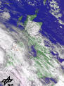 Overview for the British Isles
A wet start of next week seems very likely for most of the British Isles, with the exception of SW Ireland, which may see some drier weather. The unsettled conditions are mainly due to a filling low south of Iceland sending a weakening cold front across Britain. Temperatures around average. The far south might get some very mild air for a while. Generally cooler, but brighter weather to follow.
 Confidence is good that Tuesday and Wednesday will bring some dry and bright, if rather cold weather for England and Wales, while Ireland will remain largely unsettled with showers. Scotland and northern areas are likely to go on with the wet cold weather, even with hill snow or sleet possible.
 Thursday could well see a return to milder, if not warm spring-like weather. With highest temperatures typically in the south-west. However, most models agree that Thursday might also see more cloud again, but will remain largely dry over south-eastern areas, while another band of rain might affect the north and west. Whether this mild pattern holds for the following weekend is uncertain. There are some indications for quite pleasant Easter weather, but the confidence is still very low at present.
For further information check our regional 10-day outlook.
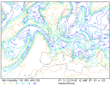
Forecast valid for Sunday, March 24th to Saturday, March 30th. This forecast is based on AVN/MRF, NCEP (ENS), WO-MOS and UKMO.