Long-range Outlook: 25/04/05 - 30/04/05
Rain for most. Generally mild.
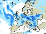
Click here for details of the weather over the next few days.
Please note that forecasting beyond five days is notoriously difficult, and small errors at short-range can lead to large deviations further in time. Our longer-range forecasts are based on the most accurate weather data available at the time, but alterations may be required as the period progresses. Please check back regularly for the most up-to-date forecast run.
Monday 25/04/05 to Tuesday 26/04/05
The new week is expected to start on an unsettled note for central and southern parts of the UK and Ireland, whilst the north has the best of the weather. On Monday, a slack area of low pressure across England, together with a weakening weather front will give a good deal of cloud to most of England and Wales, with occasional rain or showers. The showers will be heaviest during the afternoon, although there should be some brightness in between. At the same time, more persistent rain will spread into western parts of Ireland and Northern Ireland, on freshening southerly winds. The best of the dry and bright weather will be across Scotland, although with cool easterly winds the east coast may be plagued by low cloud. By Tuesday, a more vigorous area of low pressure is expected to wind itself up to the west of Ireland. This will throw outbreaks of rain across much of the UK, heavy at times. West to south-westerly winds could also touch gale force around the coasts of Ireland. Once again, Scotland will have the best of the weather, with some pleasant sunny spells.
 Wednesday 27/04/05 to Thursday 28/04/05
An area of low pressure will sit right on top of the UK by Wednesday, continuing the unsettled weather. Cloud and outbreaks of heavy rain will spread eastwards across Ireland in the morning, and into western England and Wales through the afternoon. Northern parts of Scotland will also be mostly cloudy with rain at times. Elsewhere, there will be some sunny spells during the morning, but it won't be long before heavy showers break out, with a risk of hail and thunder. Feeling warm in the sunshine, but soon cooling down as the downpours move in. The area of low pressure will gradually weaken and fill on Thursday, so there will be more emphasis on sunny periods. In fact, any morning showers across England and Wales are expected to die away altogether, to leave a much brighter afternoon. Scotland is most likely to see the heaviest showers, with a risk of thunder once again. After a mostly dry day, Ireland and Northern Ireland will become windy through the afternoon with cloud and rain reaching western areas by evening.
 Friday 29/04/05 to Saturday 30/04/05
On Friday, another area of low pressure moving in off the Atlantic will bring yet more rain across the UK and Ireland. During the morning, the heaviest and most persistent rain will be across Ireland and Northern Ireland, reaching south-west England and Wales by early afternoon. Ahead of the rain across eastern England, it will be potentially warm with some sunshine at first, although the rain will arrive by evening. Eastern Scotland may also start fine, but the rain will soon sweep in from the west. Strong south the south-westerly winds, especially through the Irish Sea. Saturday will be very wet across most of the country, as the slow-moving band of rain spreads eastwards. Some of the rain across Wales, northern England and Scotland could be very heavy indeed, with a risk of thunder. However, sheltered parts of south-east England is likely to brighten up, perhaps with the warmest temperatures so far this spring. Once the rain clears through Ireland, it will turn brighter but cooler with scattered blustery showers. Please check back for further forecast updates.