Long-range Outlook: 26/06/04 - 01/07/04
Staying generally unsettled, but it will be getting warmer!
Click here for details of the weather over the next few days.
Please note that forecasting beyond five days is notoriously difficult, and small errors at short-range can lead to large deviations further in time. Our longer-range forecasts are based on the most accurate weather data available at the time, but alterations may be required as the period progresses. Please check back regularly for the most up-to-date forecast run.
Saturday 26/06/04 to Sunday 27/06/04
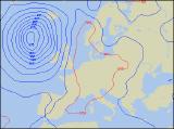
On Saturday, many central and eastern parts of England and Wales will have a short blast of warm weather, ahead of cloud and heavy rain across much of Ireland. There will be some sunshine across Scotland at first, as well as England and Wales, but through the day the rain in the west will nudge eastwards, reaching all parts towards evening. Some of the rain will be heavy, perhaps with thunder, and it will be accompanied by strong south-westerly winds, touching gale force in the west. The thundery rain may linger for a time in the south-east on Sunday morning, but it will soon clear by midday. Thereafter, most places will have a mixture of sunny spells and scattered showers. The showers will be heaviest and most frequent across western Scotland and Northern Ireland, perhaps merging to give a longer spell of rain later. Temperatures will be around average, although tempered by fresh westerly winds for many.
 Monday 28/06/04 to Tuesday 29/06/04
On Monday, there will be a good deal of dry and bright weather across England and Wales, and in some sunny spells it will begin to feel somewhat warmer. Eastern Scotland will start off rather damp before brightening up, but in western Scotland there'll be some showers around through the day. The heaviest, most frequent showers will be across Ireland with fresh westerly winds, so it'll feel rather cool here. A band of showery rain will spread across much of the UK from the west on Tuesday morning, but towards midday it should have cleared eastern parts of England and Scotland. Behind this, a ridge of high pressure will begin to build in from the south-west, ensuring that most of the UK and Ireland have a dry and fine end to the day with some sunny spells. Feeling a little fresher again at first, but the afternoon sunshine will help to lift temperatures a little above average.
 Wednesday 30/06/04 to Thursday 01/07/04
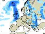
The details for Wednesday are currently a little uncertain, however it does look as if much warmer weather will affect many parts. Southerly winds will blast up across most of England, Wales and Scotland, lifting temperatures into the high twenties Celsius in the south. However, there will be the risk of one or two heavy showers during the afternoon, and across Ireland and Northern Ireland thicker cloud and heavy rain will move in from the west later. The warm weather won't last though, as heavy rain and thunderstorms break out widely across all parts on Thursday, with some localised downpours expected. Later in the day, fresher weather with sunshine and showers will move into much of Ireland and western Scotland.