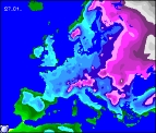
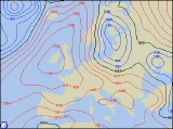
Long-range Outlook: 27/01/06 - 01/02/06
Cold, but with little chance of snow.
Click here for details of the weather over the next few days.
Please note that forecasting beyond five days is notoriously difficult, and small errors at short-range can lead to large deviations further in time. Our longer-range forecasts are based on the most accurate weather data available at the time, but alterations may be required as the period progresses. Please check back regularly for the most up-to-date forecast run.
Friday 27/01/06 to Saturday 28/01/06
In our previous forecast, we were highlighting the strong possibility that Friday would see the arrival of very cold air and a risk of snow. However, in the light of dramatically changing model data, it appears this was now rather over-zealous. Conditions will indeed be cold during Friday, but this will be the result of high pressure directly over the UK, rather than the previously forecast easterly flow. It will be dry just about everywhere in Ireland and the UK on Friday therefore, with morning frost and fog clearing to leave some sunny spells. Perhaps the outside risk of a light wintry shower on the East Coast of England. The high won't have moved far by Saturday, so much of the UK and Ireland will have another dry day with some sunny spells, once morning frost has lifted. Daytime temperatures will be just a degree or two above freezing in places. The exception on Saturday will be northern Scotland, where freshening westerly winds will blow in thicker cloud, perhaps with a risk of rain later. Turning milder in the north.
 Sunday 29/01/06 to Monday 30/01/06
On Sunday, high pressure is expected to nudge westwards to become centred over Ireland. The will allow milder north-westerly winds to topple across the top of the high, spreading a lot of cloud across Scotland and eastern parts of England. This cloud will be thick enough for patchy rain across northern Scotland, together with north-east England, but elsewhere it will stay dry. The rest of England and Wales, together with Ireland, will be dry with sunny spells, although there will be a hard frost during the morning, with a few fog patches slow to clear. There won't be a good deal of change on Monday, as high pressure continues to give a lot of settled weather. The best of the sunshine will once again be across the Irish Republic, Wales, and south-western parts of England, with overnight frost and fog clearing. Northern Ireland, Scotland, and north-east England will be cloudier and milder, still with a risk of coastal drizzle or light rain. Winds will be light for most, but fresh across northern and eastern areas.
 Tuesday 31/01/06 to Wednesday 01/02/06
There's a fair amount of disagreement in the forecast models for Tuesday, with varying scenarios suggesting what may happen to our resident high. However, we expect conditions during Tuesday to differ very little to that of Monday, with sunshine in the south and west, and more cloud across the north and east. However, as westerly winds freshen during the second half of the day, heavy and persistent rain looks like racing across Northern Ireland and Scotland. It'll be 'all-change' on Wednesday, as our high finally gives up, allowing Atlantic air and weather fronts to sweep south-east across most of the UK and Ireland. Some quite heavy bursts of rain are likely during the day, and very few places will escape. Gales are likely around northern and western coasts too, as conditions become much milder. However, there is some uncertainty surrounding next week's weather, so please check back for further updates.