Long-range Outlook: 27/12/04 - 01/01/05
Milder, but with strong winds and rain.
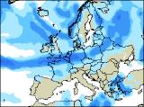
Click here for details of the weather over the next few days, and here for your chances of a white Christmas!.
Please note that forecasting beyond five days is notoriously difficult, and small errors at short-range can lead to large deviations further in time. Our longer-range forecasts are based on the most accurate weather data available at the time, but alterations may be required as the period progresses. Please check back regularly for the most up-to-date forecast run.
Monday 27/12/04 to Tuesday 28/12/04
Milder air will have flooded across all parts of the UK and Ireland by Monday, but this will bring with it its own hazards. In particular, westerly winds will be very strong, especially across western Scotland and Northern Ireland where gales are likely. Heavy rain will also set in across these areas during the day, and together with the thaw of lying snow some local flooding is likely. The rain will spread east to most of Ireland and northern England in the afternoon. The rest of England and Wales will be rather cloudy, with drizzle around western coasts. Perhaps some brightness to the lee of high ground. Tuesday will stay very mild and also very windy, with an ongoing risk of westerly gales across Scotland, Northern Ireland and northern England. The rain, associated with a waving weather front, will have become slow moving from Ireland, across Wales and the Midlands to East Anglia. Sunshing and showers further north, whilst the south will be cloudy but mostly dry.
 Wednesday 29/12/04 to Thursday 30/12/04
On Wednesday, the winds will have turned more north-westerly across Scotland and Northern Ireland, introducing colder air. However, it will still be rather cloudy as another band of rain spreads south, turning to snow over the hills later. Ireland, northern England and north Wales will be mostly dry, perhaps with some sunny spells too. Rain will still plague south Wales and southern parts of England, with the potential for some heavy bursts at times. North-westerly winds everywhere on Thursday, so feeling less mild than of late. The wind will at least have moved any remaining rain away from southern England, and England and Wales will be left with a dry and bright afternoon. Scotland and Northern Ireland will have plenty of showers, many falling as sleet and snow above 200m, with hail at lower levels. The north-west wind will touch gale force at times, and it will be very squally. The showers will spread south to Ireland, and perhaps north Wales later.
 New Year's Eve 31/12/04 to New Year's Day 01/01/05
The weather on New Year's Eve is expected to be fine and settled, as a ridge of high pressure drifts over the UK. Morning frost will disappear, leaving a chilly but bright day, with lots of sunshine. The best of the sunny spells will be across southern and eastern England, closest to the ridge centre. However, thickening cloud will bring outbreaks of rain from the west across most of Northern Ireland and Scotland during the afternoon, with some snow over the hills for a time. New Year's Day is looking very unsettled, as a deep area of low pressure gives very strong winds and plenty of heavy rain. The wet weather will affect all areas, with gales through the Irish Sea and across the north-west. Following the rain, colder air and snow showers will blast into northern parts of Scotland, heralding a potential cold snap for the new year. As ever, please check back for further forecast updates.