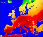
Long-range Outlook: 28/05/05 - 02/06/05
Fine on Sunday. Otherwise rain or showers!
Click here for details of the weather over the next few days.
Please note that forecasting beyond five days is notoriously difficult, and small errors at short-range can lead to large deviations further in time. Our longer-range forecasts are based on the most accurate weather data available at the time, but alterations may be required as the period progresses. Please check back regularly for the most up-to-date forecast run.
Saturday 28/05/05 to Sunday 29/05/05
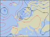
Saturday will see a continuation of the unsettled weather, with a large area of low pressure close to the UK. Outbreaks of showery rain will affect much of Scotland and northern England through the day, often heavy and prolonged. The rain will also affect Northern Ireland at first, although it will turn brighter with showers later. Ireland will be mostly dry with some sunshine, as will south-east England at first, where it will be potentially very warm. However, cloud and showers across the rest of England and Wales will spread east later, affecting the south-east by evening. Turning cooler behind the rain later, as a fresh north-westerly wind develops. At long last, it does look like Sunday will be more settled across most places, as high pressure ridges in from the west. For most of England, Wales and Scotland it will be dry with plenty of sunshine, and only patchy fair-weather cloud in the afternoon. Ireland and Northern Ireland will also be fine at first, but cloud will increase from the west in the afternoon, with rain by evening. Feeling warm in the sunshine and light winds, although Ireland will become windier later.
 Monday 30/05/05 to Tuesday 31/05/05
On Monday, high pressure should keep its influence across south Wales, the Midlands, southern England and East Anglia. Therefore, these areas can expect another dry day, with variable cloud and sunny spells. However, further north across north Wales and northern England, it will be cloudier with a risk of rain later. The heaviest, most persistent rain will be reserved for Scotland and Northern Ireland, and it will generally be a wet day here. South-westerly winds will be mostly light, although will continue to be fresh across Ireland and Northern Ireland. Low pressure will return with a vengeance on Tuesday, giving heavy and persistent rain across much of the country. The most intense rain will be across Northern Ireland and Scotland during the morning and early afternoon, whilst the rain across southern England will be fairly light and patchy. Later in the afternoon, the rain will clear to sunny spells and scattered heavy showers across Ireland and south-western parts of England. Temperatures around average, but feeling cooler in a fresh wind.
 Wednesday 01/06/05 to Thursday 02/06/05
The outlook for Wednesday and Thursday is potentially very unsettled, and thoroughly miserable. With no sign of summer becoming established for the start of June, low pressure will be firmly parked over the UK for the middle of next week. Whilst details are difficult to determine at this range, it is safe to say that most of the UK will have cloud and rain at some point during Wednesday and Thursday, accompanied by strong winds. There is a glimmer of hope later on Thursday though, with brighter weather returning across Scotland, Ireland and Northern Ireland. However, for more detailed outlooks on the weather for next week, please check back for further forecast updates.