Long-range Outlook: 29/10/04 - 03/11/04
Unsettled at first. Fine for a time later.
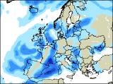
Click here for details of the weather over the next few days.
Please note that forecasting beyond five days is notoriously difficult, and small errors at short-range can lead to large deviations further in time. Our longer-range forecasts are based on the most accurate weather data available at the time, but alterations may be required as the period progresses. Please check back regularly for the most up-to-date forecast run.
Friday 29/10/04 to Saturday 30/10/04
Low pressure will remain to the south-west of the UK during Friday, ensuring many parts hang on to unsettled conditions. Outbreaks of showery rain will be persistent and heavy at times across south-west England, Wales and much of Ireland. Elsewhere, although there will be some sunny spells, heavy showers will become more widespread with the risk of thunder. Southerly winds will remain strong, with coastal gales around south-west England. On Saturday, the low will finally begin to pull away southwards across France, taking most of the heavy rain with it. The rain may linger along the south coast for a time, but it will turn brighter in the afternoon. However, more weather fronts will give cloudy skies and showery rain across much of Scotland, Northern Ireland and north-east England, although the winds everywhere will be much lighter.
 Sunday 31/10/04 to Monday 01/11/04
A very weak ridge of high pressure is likely to influence the weather across a large part of England and Wales on Sunday, with a lot of cloud and some sunny spells. However, weak weather fronts will still affect much of Ireland and Northern Ireland, along with western parts of Scotland and north-west England. These will give occasional light rain or drizzle, and it will be very misty with fog over the hills. Eastern Scotland and north-east England should stay dry, if rather grey. On Monday, the high will become more established across England and Wales, giving some sunny spells. However, it will be rather chilly overnight, with ground frost and fog patches in places. Once again, with freshening south-westerly winds, most of Ireland and Scotland will remain cloudy with outbreaks of showery rain, turning heavy later.
 Tuesday 02/11/04 to Wednesday 03/11/04
Detail on Tuesday is currently uncertain, but it does look as if a large part of the country with be settled with sunny spells. Once again, overnight frost and fog patches will be slow to clear, particularly across central and eastern England. The exceptions will be Northern Ireland and western Scotland, where strong south-westerly winds will still bring outbreaks of rain across most parts, heavy at times. By Wednesday, the heavy rain is expected to track further eastwards, reaching all of Ireland during the day. Western parts of England and much of Wales will also turn wet during the afternoon. After a foggy start, the settled, bright conditions will hold on across eastern parts of England. Please check back for further forecast updates.