The week ahead
Spring break
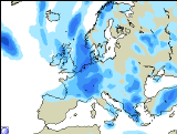
Forecast valid for Sunday 28/04/02 to Saturday 04/05/02 TOI Thursday 25/04/02 1800 BST. Based on MRF, ECMWF, UKMO, and ENS labelled model.
Very high confidence (90%) for a week that will see rain in all areas, often windy and at times, rather cold. Towards the end of the period, it is likely (60% chance) that the SE of the British Isles will become dry again and somewhat warmer.
 Rain will clear away from eastern areas on Sunday morning then the rest of day will see sunny intervals and showers. In the the west some of the showers will be squally with hail and thunder and falling as snow on Scottish hills in heavier showers. By evening southern parts should become mainly dry with some late sunshine. Temperatures will be around normal but falling quickly in heavy showers.
On Monday the northern half of the British Isles will continue to see showers or longer periods of rain in association with an area of low pressure over Scotland. Some of the showers will again be heavy with localised hail and thunder. Central and southern parts will have more scattered showers but it will be breezy with sunny spells in the south. Temperatures again around normal but with large variations around showers.
 On Tuesday a brief ridge of high pressure will mean a much quieter day with plenty of sunshine and only scattered showers, mainly in the north. Temperatures around normal with lighter winds in the south.
The rest of the week looks like remaining changeable with more showers or longer periods of rain as another Atlantic low pushes into the British Isles with possibly some very strong winds at times, particularly in the north and west. (Daily detail is impossible at this stage due to the inherent volatility in the cyclonic pattern). However, on Friday and Saturday SE England looks like turning dry and warmer as pressure builds again from the south.
The trend for the following week starting 5th May with low confidence is for it to remain changeable in the north, but warmer. Becoming mainly dry in England and Wales.
This forecast has been prepared personally by Will Hand who will take no responsibility whatsoever for any matters arising from the use of information provided.