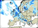
Long-range Outlook: 29/06/05 - 04/07/05
Increasingly cool with rain for many.
Click here for details of the weather over the next few days.
Please note that forecasting beyond five days is notoriously difficult, and small errors at short-range can lead to large deviations further in time. Our longer-range forecasts are based on the most accurate weather data available at the time, but alterations may be required as the period progresses. Please check back regularly for the most up-to-date forecast run.
Wednesday 29/06/05 to Thursday 30/06/05
Eastern parts of England will have a very humid day on Wednesday, with some sunshine during the morning. However, showery bursts of rain will affect much of western England and Wales, with a risk of thunder in places. The rain may be extensive enough to reach eastern parts of Ireland and Northern Ireland too, but western areas will be drier and brighter. After a dry but humid start, the rain will reach Scotland, once again with thunder over the mountains. Western parts of the UK will gradually become cooler and fresher after a muggy morning. On Thursday, there will be the chance of one or two thunderstorms in south-east England first thing. Otherwise, much of the UK will start dry with some sunshine, and it will feel much fresher everywhere. During the afternoon, increasing cloud will spread rain and drizzle across Ireland and Northern Ireland, reaching western Scotland and north-west England by evening. The rest of the UK will have a drier afternoon with occasional sunny spells.
 Friday 01/07/05 to Saturday 02/07/05
On Friday, outbreaks of rain will affect most of Ireland and Scotland throughout the day, although it will be very sporadic in eastern Scotland. It will also be mostly cloudy across north-west England and west Wales, with low cloud and mist affecting the coasts of south-west England. Eastern Wales and the rest of England will have more cloud around than recently, but there will still be some sunshine between the clouds. Feeling warm in the sunshine, and turning humid again in the south-east. On Saturday, a large area of low pressure to the west of the UK will deepen, setting the scene for an unsettled day across western areas. Overnight rain will have cleared from south-east England during the morning, leaving much of eastern England with a bright, but fresher day. Elsewhere, there will be a lot of cloud, with showery bursts of rain. This will be heaviest and most persistent across Northern Ireland and western Scotland, and it will feel increasingly cool in freshening winds.
 Sunday 03/07/05 to Monday 04/07/05
Sunday is looking like an unsettled day everywhere, with showers or longer spells of rain. As low pressure shifts into the North Sea, a north-westerly breeze will develop, making it feel a good deal cooler everywhere. There should be some sunny spells between the showers across England and Wales, especially in western areas. On Monday, the low to the east of the UK is expected to deepen once again, pulling in stronger north-westerly winds. Cloud and rain will spread southwards along North Sea coasts, with some heavy bursts in places. Further west, it will be brighter but still with a risk of showers. The best of any sunny weather will be across sheltered central and southern parts of Ireland. Feeling cool everywhere. For more details on the weather next week, please check back for further forecast updates.