Long-range Outlook: 29/07/04 - 03/08/04
Becoming warmer but with the risk of heavy rain next week.
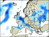
Click here for details of the weather over the next few days.
Please note that forecasting beyond five days is notoriously difficult, and small errors at short-range can lead to large deviations further in time. Our longer-range forecasts are based on the most accurate weather data available at the time, but alterations may be required as the period progresses. Please check back regularly for the most up-to-date forecast run.
Thursday 29/07/04 to Friday 30/07/04
For much of England, Wales and Scotland on Thursday, it will be a bright day with some sunny spells. However, it will become very warm and rather humid, sparking off a few heavy showers and thunderstorms by mid-afternoon. These will be mostly likely across the Midlands and northern England. Low pressure to the west, and an associated cold front will give a good deal of cloud across Ireland and Northern Ireland, with outbreaks of heavy rain during the day. On Friday, the generally fine and sunny weather will continue in eastern Scotland, along with central and eastern England, with warm temperatures expected. Across the rest of England, Wales and western Scotland, there will be more cloud around with the risk of showery rain, some heavy with the slight risk of thunder. It will be fresher across most of Ireland, with westerly winds giving a mixture of sunny spells and scattered showers.
 Saturday 31/07/04 Sunday 01/07/04
On Saturday, it looks as if the UK will be trapped in a "col" situation (the area between 2 high pressure and 2 low pressure centres). In summer, these tend to bring with them some warm sunny spells, but also a good deal of cloud. Showers will break out during the afternoon, mostly through the spine of England, and over the high ground of Wales. Some of the showers will be heavy and thundery, but Scotland and Northern Ireland should remain largely dry. On Sunday, with high pressure to the east and low pressure to the west, there will be a strong southerly flow across the UK and Ireland. This will spell out very warm conditions with some sunshine, especially across southern England and Wales. Scattered showers may still develop across parts of Scotland and Northern Ireland however, and later in the day cloud will thicken across western parts of Ireland.
 Monday 02/08/04 Tuesday 03/08/04
At present, the start of next week is looking very unsettled, but also very warm. On Monday, with southerly winds persisting, conditions will be very humid, with any sunny spells soon triggering heavy downpours and thunderstorms. Across Ireland, more persistent heavy rain will spread slowly from the west, and again this may be thundery in places. By Tuesday, this rain will become slow moving over England, Wales and Scotland. Once again, it will be very heavy in places with embedded thunderstorms, giving the potential for localised flash flooding. Please check back for later forecasts, regarding the detail on next week's weather.