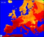
Long-range Outlook: 02/08/04 - 07/08/04
A very warm start, but becoming increasingly thundery. Fresher later.
Click here for details of the weather over the next few days.
Please note that forecasting beyond five days is notoriously difficult, and small errors at short-range can lead to large deviations further in time. Our longer-range forecasts are based on the most accurate weather data available at the time, but alterations may be required as the period progresses. Please check back regularly for the most up-to-date forecast run.
Monday 02/08/04 to Tuesday 03/08/04
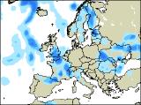
Summer will be in full swing across most places on Monday, with some warm sunshine around. The best of the sunshine will be across central and eastern parts of England together with Wales, where temperatures will be in the high twenties Celsius. However, as ever with hot southerly flows, fronts out to the west will give rather more cloud across Ireland, with scattered heavy downpours developing in the afternoon. These may affect south-west England by evening with the risk of thunderstorms. On Tuesday, it will remain very warm or even hot, but there will be more cloud around. This will threaten heavy downpours and thunderstorms, especially across Scotland, northern England and Wales. The extreme east of England should stay dry with some hot sunshine, and later in the afternoon Ireland and Northern Ireland will become brighter and fresher. Light southerly winds in most places, becoming westerly behind the thundery rain.
 Wednesday 04/08/04 Thursday 05/08/04
Any remaining rain will quickly clear from north-east England and eastern Scotland on Wednesday morning, leaving much of the UK and Ireland dry with sunny spells. Although fresher, it will still remain warm with temperatures in the low to mid twenties Celsius. However, cloud will bubble up across central and southern England, along with Wales in the afternoon, with showers breaking out, some thundery with torrential falls likely. This may merge to give more prolonged thundery rain across southern England later. Weather fronts will spread from the west on Wednesday night and into Thursday, bringing outbreaks of rain across most parts. Some of the rain will be heavy during Thursday afternoon, with a scattering of thunderstorms breaking out ahead of the rain, across eastern parts of England. Ireland and Northern Ireland will brighten up again later, with sunshine and scattered showers. Staying warm everywhere, still rather humid in the south and east.
 Friday 06/08/04 Saturday 07/08/04
Friday is currently looking unsettled, but still warm, with light south or south-easterly winds. There will be some sunny spells around, but also a good deal of cloud. Across eastern parts, it will also be fairly humid, with thundery showers breaking out in the afternoon. Elsewhere, there will be just a scattering of showers, and across in Ireland it will be somewhat fresher with fewer showers here. Saturday is looking very similar, with bright spells and heavy downpours developing. However, there's the threat of more prolonged rain spreading from the south in the afternoon.