Weekly Outlook : 30/06/03-06/07/03
Summer On The Backburner! Rain/Showers for Most. Drier Weekend.
 Monday 30/06/03 to Tuesday 01/07/03
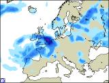
Monday will set the theme for an unsettled week, with wet weather spreading north. The heaviest, most persistent rain will be across North Wales, Northern Ireland and Northern England by the afternoon, where it will become slow moving. To the south of this, gradually becoming drier if rather cloudy, with one or two showers in the south and east. To the north, a brighter day with plenty of dry weather about. Mild for many, despite the cloud and rain. Remaining wet across Northern England, Ireland and southern Scotland overnight and into Tuesday, with the rain slipping southwards again into North Wales and the Midlands during the Tuesday afternoon. Across southern parts, bright spells but also some heavy, thundery showers. Across the rest of Scotland and Northern Ireland, another bright day, with the exception of the far North-east, where it may remain drizzly. A keen north-easterly wind here making it feel decidedly chilly, but still mild in the south.
 Wednesday 02/07/03 to Thursday 03/07/03
During Wednesday morning, the rain will slip southwards across southern England, although becoming mostly light and patchy. Behind this skies will brighten, with a good deal of sunshine but also a number of showers, especially across eastern parts. A stiff northerly wind will make it feel cooler than it has for quite some time, especially across Scotland. Overnight, the last of the cloud will clear southern parts, then many places will be dry and rather chilly. Into Thursday, showers will continue along eastern coasts, where it will be rather cloudy and breezy. Elsewhere, a fresh but bright day, with some good sunny spells. There will be one or two scattered afternoon showers across central parts, but most places remaining dry. Once again, the northerly flow making it feel chilly, but pleasant enough in the sunshine.
 Friday 04/07/03 to Sunday 06/07/03
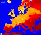
During Friday, showers will continue in eastern parts, perhaps also across the north, but becoming fewer and further between during the afternoon. Elsewhere, mostly dry with some sunshine, and slowly becoming warmer once more. This trend looks set to continue through the weekend, with high pressure likely to build gradually from the south-west. There will be cloud floating around however, so not all parts will see long sunny spells. It will warm up however, with temperatures reaching the mid twenties celsius in the south by Sunday. Next weekly update - 03/06.