Weekly Outlook : 31/07/03-06/08/03
Unsettled To Start. Summer Returning from the Weekend Onwards!
 Thursday 31/07/03 to Friday 01/08/03
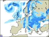
The unsettled theme continuing on Thursday, with low pressure spreading cloud and rain in from the west. Central and eastern England, along with eastern Scotland will have a dry morning with some brightness. Cloud will increase from the west as rain, already across Ireland, Wales and western England spreads eastwards. Most of the rain will be light and patchy, perhaps heavier over high ground. The south-east may remain dry until after dark. Overnight, rain will become slow moving across the country, mostly light but perhaps heavier in the south-west by Friday morning. A muggy start, and the morning will remain cloudy and drizzly across England and Wales. This will become confined to the south-east during the afternoon, as brighter skies with sunny spells and scattered showers filter eastwards elsewhere. Winds will become strong, possible gales in the north-west, and it will turn cooler. Further showers in the west during the evening, becoming dry and clear elsewhere.
 Saturday 02/08/03 to Sunday 03/08/03
The beginning of a change, at least for southern parts on Saturday. With the exception of the extreme south-east which may stay mostly cloudy, England and Wales will see bright or sunny spells and only isolated showers. Feeling warmer in the sunshine and in lighter winds. Northern Ireland and Scotland staying breezy with showers spreading from the west, and turning cloudy in south-west Ireland later in the afternoon. During Saturday night and into Sunday, high pressure will become established across southern parts. This means that most parts will be dry with sunny spells during Sunday, and becoming warm in central regions. The exception will be western parts of Ireland and Northern Ireland, possibly western Scotland later as weather fronts brush by, bringing thicker cloud and spots of rain. A dry night for most.
 Monday 04/08/03 to Wednesday 06/08/03
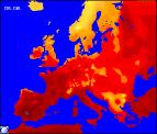
The road to recovery from Monday, as summer is set to return. High pressure is expected to form a block over the UK and Ireland, forcing low pressure systems to our north. Sunshine is expected to increase for Monday, some parts seeing wall to wall sunshine. Patchy cloud will develop in hillier areas, and cloud may prove stubborn to clear northern Scotland during the morning. During Tuesday and into Wednesday, all parts seeing warm sunshine and light winds, with temperatures reaching the mid twenties Celsius, perhaps higher in places. Confidence is high at the moment of the summer scenario returning, but as ever further detail will be included in the next forecast update.